
LOUISVILLE, Ky. — A complex of thunderstorms has entered the WHAS11 viewing area. While the tornado threat is diminishing for much of our area, storms still could producer strong wind and heavy rain through midnight. A flood watch is in effect through 8 am Thursday. The farther to the southwest you live in Kentucky, the higher the threat of severe storms.

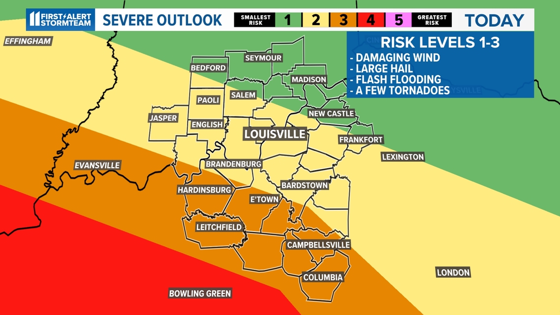
The overall severe weather concern will come to a halt by midnight tonight as the storms will push southward. Left behind will only be some light rainfall for locations south of the Bluegrass and Western Kentucky Parkways. Low temperatures will stick to the balmy middle 60s with plenty of humidity.
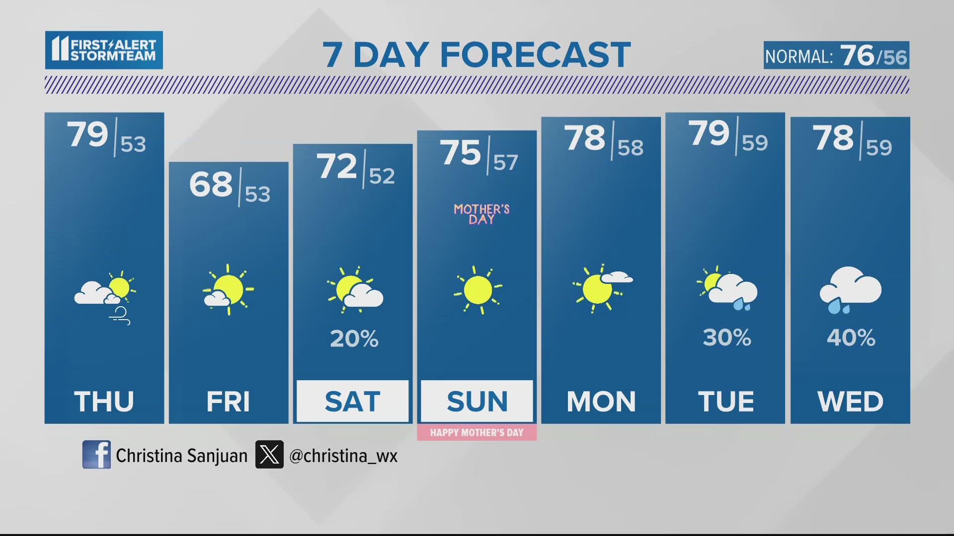
Here comes the cold front! Drier air, mixed with a westerly breeze and an array of sun and clouds comes our way for tomorrow afternoon as well as Friday. We will hold onto a quiet pattern to close out the week with more sun and clouds on Friday. A slight chance for a passing rain shower is in the forecast on Friday afternoon and some light rain may arrive Saturday afternoon. Otherwise, plan on a quiet weekend ahead!
Monday marks the first day of practice for golfers at the PGA Championships and our forecast calls for comfortable temperatures and a slight chance for hit or miss showers Monday and Tuesday.
Please make sure you have a severe weather safety kit, plenty of water and a reliable way to receive severe weather alerts and updates. For additional storm preparedness tips, click here.
Download the free WHAS11 app to watch live coverage during severe weather and get real-time weather alerts, even if your power goes out. For Apple or Android users.
---------------
TONIGHT: Showers and storms ending by midnight. Low: 66°. Wind: S 5-15 mph.
THURSDAY: Clouds decrease through the day. Slight chance for a spotty shower north. High: 79°. Wind: W 10-20 mph.
FRIDAY: Much cooler! Mostly dry. High: 68°.
---------------
LIVE RADAR
Related video
More from the First Alert StormTeam

Follow the First Alert StormTeam on social media.
DOWNLOAD THE WHAS11 APP:
Download the free WHAS11 app for the latest weather alerts from the First Alert StormTeam. For Apple or Android users.
JOIN THE CLOUD WATCHERS FACEBOOK GROUP:
Interested in photography? Join nearly 8,000 residents from Kentucky and southern Indiana and share your weather photos. Click here to join the group!